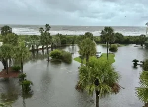
Flooding has become so routine on Isle of Palms that despite the inconvenience it often causes for residents and public works personnel, it is something everyone just lives with as a normal part of the environment.
“Other southeastern coastal cities face similar problems but with one caveat: the Lowcountry of South Carolina is low,” said Norman Levine, director of the Santee Cooper GIS Laboratory and Lowcountry Hazards Center at the College of Charleston. “Over one-third of all homes are built on land that sits below 10 feet (3 meters) of elevation.”
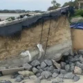
Specifically, Isle of Palms is about 11 feet above sea level – only 2 feet higher than neighboring Sullivan’s Island – making it susceptible to fallout from hurricanes and major storms. Despite its longtime resiliency and having been spared the worst of major hurricane disasters, the island is constantly in need of measures to control erosion and flooding.
 Other measures include ongoing beach nourishments since 1983 to combat erosion; an island-wide Sea Level Rise Adaptation Plan to address long-term potential threats of eventually sinking; and most recently, a $1.08 million grant from the Federal Emergency Management Agency (FEMA) for improvements to Waterway Boulevard. The intention is to protect the boulevard from king tides, which currently inundate areas of the island several times a year, including an area surrounding a city fire station.
“The Waterway Boulevard Pathway Improvements project is the only City of Isle of Palms grant project funded by FEMA under the Hazard Mitigation Grant Program (HMGP) in the past 10 years,” said Emily Bentley, chief of recovery and mitigation with the South Carolina Emergency Management Division, a partner of FEMA. “HMGP grants are reimbursement-based… The city has to expend funds on the approved scope of work and submit documentation of actual costs to get reimbursed.”
During Tropical Storm Debby this past August, the city’s Phase 3 Drainage plan not only rerouted much of the flood water, but structures were made to handle a larger capacity. Phase 4 Drainage is also underway for Palm Boulevard, between 38th and 41st avenues.
“The height of the structures and final grades were designed so that these sites may be easily incorporated into the city’s strategic plan to combat sea level rise,” said Hillary Aton, project manager with Thomas & Hutton engineering services in Mount Pleasant. Aton pointed out that the entire section of the Phase 4 Drainage will have to be reinforced from scratch because it “does not have any existing drainage infrastructure.”
All of these measures, however, are not permanent guarantees for keeping nature away. City leaders currently anticipate that beach nourishment projects need to occur every eight to 10 years.
“Right now, we’re looking at a cost of maybe $18-20 million for two large-scale projects,” said City Administrator Desirée Fragoso this past summer.
More so, Steven Traynum, engineering consultant for IOP City and president of Coastal Science & Engineering in Columbia, added that beach nourishments have been even more critical in recent years because island erosion has “outpaced natural sand flow.”
“South IOP, south Wild Dunes and north Wild Dunes are currently the most eroded areas – we’ve lost about 100,000 cubic yards of sand in these three sections every year from 2008- 2018,” Traynum said, adding that the east end of the island has lost about “254,000 cubic yards of sand per year since 2018.” That’s an equivalent volume of approximately 78 Olympic-size pools.
“Given enough time, nature could severely and permanently erode much of the island’s central and eastern areas,” Traynum said.
It’s a concern facing U.S. cities along the entire East Coast, including Boston, New York, Baltimore, Norfolk and Charleston, which NASA’s Earth Observatory has named as one of the fastest sinking cities (about 4 millimeters per year) in the eastern U.S.
All of which means that for Isle of Palms and all of Charleston County, current strategies to control flooding and the money needed to implement them could very soon go hand-in-hand with all future development.
“We are not saying don’t develop at all – we are saying to develop wisely, carefully, sensibly, given the current and future flood risks,” said Dale Morris, former head of resilience and sustainability with the City of Charleston, and co-author of a 2019 report that assessed the region’s flood risks. “Those risks are not going to decrease. We have a bias: to work with the natural and ecological systems that are here. If you ignore them, Mother Nature eventually will win.”
By L. C. Leach III


Leave a Reply